![2. alt [Inventory of high voltage power line 110 kV – eltelnetworks.pl]](https://res.cloudinary.com/eltelnetworks/image/upload/f_auto,dpr_auto,q_auto,fl_progressive/w_767,h_433,c_scale/www-production-cms12/episerver/2a2a0e29-04b1-4b4a-b554-383b31ef6232/cs15_drony_2.jpg)
FACTS
Investor: own order
Location: Goleniów poviat, Zachodniopomorskie Voivodship
Completion: 2022
![3. alt [Identification and recording of the current state of the terrain under the high-voltage power line – eltelnetworks.pl]](https://res.cloudinary.com/eltelnetworks/image/upload/f_auto,dpr_auto,q_auto,fl_progressive/w_767,h_433,c_scale/www-production-cms12/episerver/fbe2c84c-cbd0-40f1-9c70-f905bf534d64/cs15_drony_3.jpg)
LINE DATA
- 110 kV overhead power line
- 18,2 km power line, MSP Maszewo – MSP Nowogard
- 71 towers (strong, though, end)
CHALLENGE
One of the important elements of the modernization of the power line is the need to inventory its current state before the commencement of construction works in a given area. The inventory makes it possible to identify and document the current state of the area in the vicinity of the given power line, including:
- topography
- network of roads and buildings
- vegetation (area, height, density, quality)
- differences between the records of maps and documents and the actual state in the field
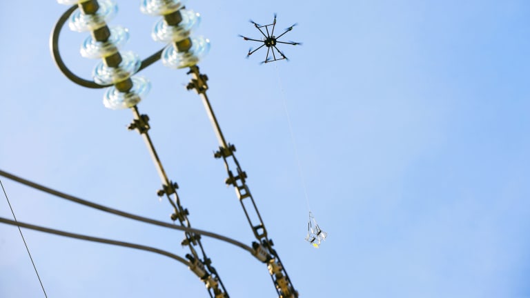
Taking into account the aspect of time, i.e., the key factor of executive works in the power industry, we decided to make an inventory of the high-voltage lines of the MSP (Main Supply Point) Maszewo – MSP Nowogard connection in the Goleniów poviat "from the air". We used a drone, i.e., an unmanned aerial vehicle to carry out the work. The use of this innovative solution allowed us to perform an accurate test flight of approx. 20 km of power line and a significant reduction in working time compared to the inventory of the line made "from the ground".
EFFECT
The result of our work, carried out with the help of a drone, was the performance of a professional inventory of the modernized 110 kV power line between MSP Maszewo and MSP Nowogard. We obtained a detailed video of the flight of about 20 km above the overhead line and an orthophoto map, which we used to get acquainted with the current state of development around the power line, allowed us to predict possible difficulties in the performance of works and find convenient access routes to the sites. Additionally, the performed orthophoto map is a reliable proof of the existing state of the power line surroundings.
The experience gained shows that the use of a drone in the power industry is an excellent alternative to traditional methods and brings several measurable benefits to the customer:
- possibility to work on MV, HV and LV lines
- possibility of quick mobilization and taking the order
- competitive price compared to other solutions
- speed of task completion
- works in technology without switching off the voltage
- safety – no risk to human life
- no heavy equipment involved
- no need to obtain permits to enter the area
- ecological method of work
- possible execution of works in difficult terrain (rivers, lakes, wetlands, intersections with overhead lines, etc.)
The obtained data is an important source of information both at the stage of designing the energy infrastructure, as well as the construction, operation and modernization of the power line. Our innovative solution using a drone allowed us to perform work in a quick, effective and safe way, as well as significantly reducing investment costs.

![1. alt [Use of a drone for the inventory of the modernized 110 kV power line between substations Maszewo - Nowogard - eltelnetworks.pl]](https://res.cloudinary.com/eltelnetworks/image/upload/f_auto,dpr_auto,q_auto,fl_progressive/w_1348,h_1078,c_fill,g_auto/w_768,h_614,c_scale/www-production-cms12/episerver/edc207e3-9e19-466e-a05b-8a045fa40cdb/cs15_drony_1.jpg)


